Hackney Map
Sunday, December 5, 2010
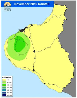
Isohyet
http://www.trc.govt.nz/previous-month-and-year-to-date/
An isohyet uses contour lines to represent the amount of rainfall on a map. Each color in the above map shows the different amount of perception month to data for that location.
No comments:
Post a Comment
Newer Post
Older Post
Home
Subscribe to:
Post Comments (Atom)
No comments:
Post a Comment